The Challenges of Distance Estimation at Sea
Lack of Scale
At sea, objects often appear closer or farther than they truly are because the water surface is uniform and featureless. Without familiar reference points (such as trees, buildings, or roads), human perception struggles to judge size and distance.
Atmospheric Distortion
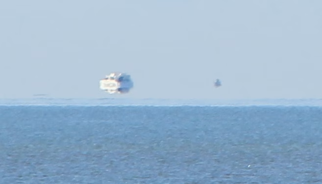
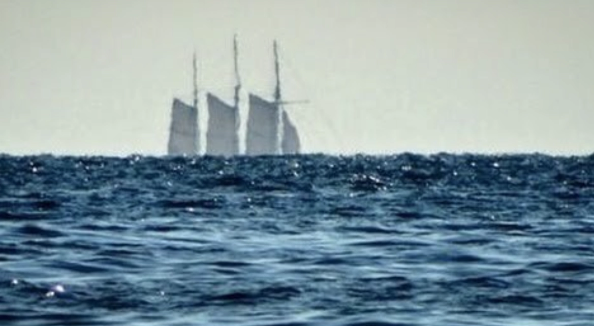
Refraction, haze, mist, or strong sunlight can distort vision. A ship on the horizon may appear “loomed” upward by atmospheric refraction, making it seem closer than it actually is.
Curvature of the Earth
The horizon at sea is not infinitely far. For an observer standing on deck, the Earth’s curvature hides objects beyond a certain distance, which changes depending on eye height above sea level.
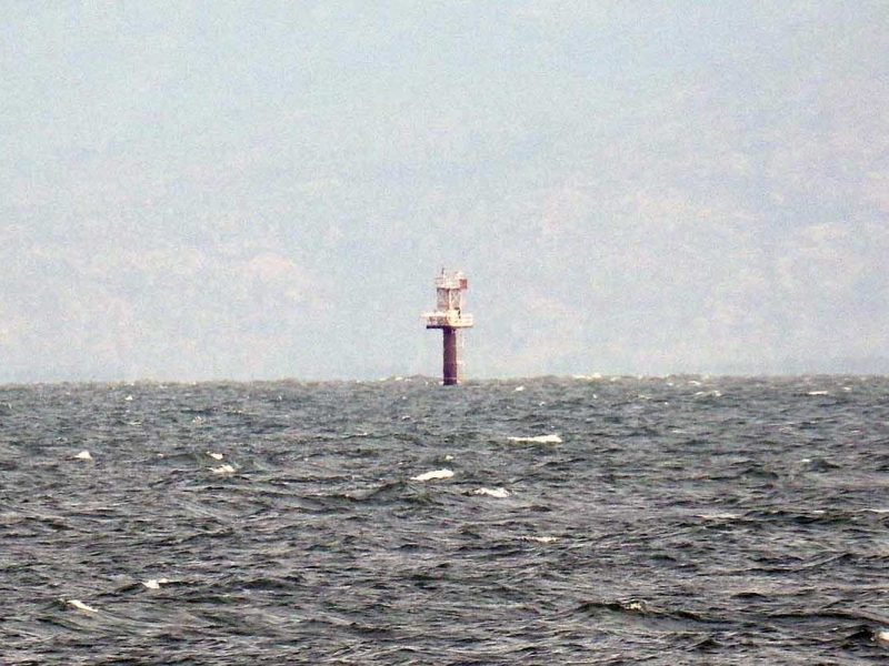
Relative Size Illusion
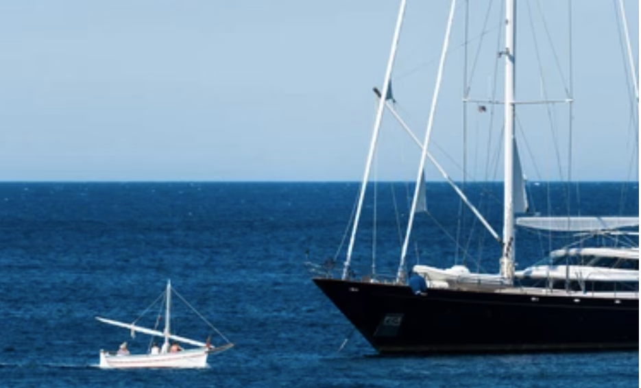
A small yacht nearby and a large tanker far away may appear the same size to the eye, leading to misjudgments. Only with experience can a sailor quickly recognise such scale differences.
1. The Horizon Formula
A fundamental technique uses geometry to determine how far the horizon is from the observer:
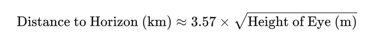
Where:
Distance is in kilometres (km)
Height of eye is in metres (m) above sea level
Example: Sailor Standing on a Yacht
Height of eye: 2 m (average person standing on the deck of a small boat)
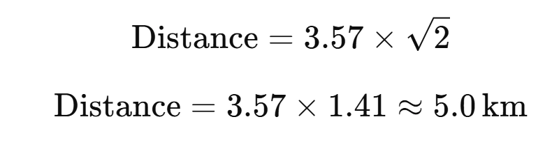
So the horizon is about 5 km (≈ 2.7 nautical miles) away.
For more on this, visit this article, “The Distance to the Horizon”
Hint – Calculate your eye level height on your boat by standing where you would typically take a measurement. That way, you’re half done by the time you require this technique.
2. Lighthouse and Landmark Ranges
Nautical charts provide the “nominal range” of lights and landmarks based on visibility. By comparing the time when a light comes into view with your charted position, you can estimate distance fairly accurately.
Practical Example at Sea
Sailing off the coast, your chart shows a lighthouse: Fl(2)10s 45m 20M
- Your yacht has an eye height of 3 m
- You suddenly spot the light just above the horizon
- By calculation, your distance is about 16 nm from the lighthouse.
If you later see the lighthouse clearly well above the horizon and its base visible in daylight, you may be within 10 nm or less. Read more…
At Night – Navigation Lights as a Guide
Masthead and sidelights barely visible → usually > 5 nm (depending on bulb strength and conditions).
Distinct separation between sidelights (red/green) and masthead → ~2–3 nm.
Light reflections on the water are often very close to < 1 nm.
(Note: Ranges of navigation lights are standardised — e.g., sidelights are visible for 2–3 nm depending on vessel size. If you begin to see them, you’re probably near that distance.)
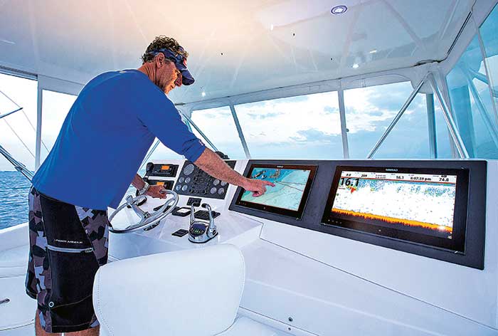
3. Radar and Electronic Aids
Radar: Provides direct, reliable distance readings, unaffected by visual illusions.
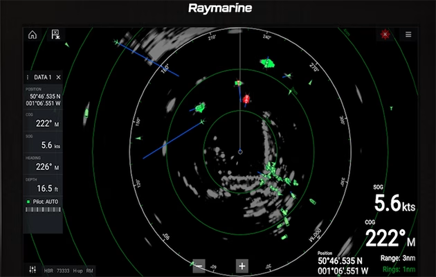
AIS (Automatic Identification System): Supplies both position and range of vessels transmitting their data.
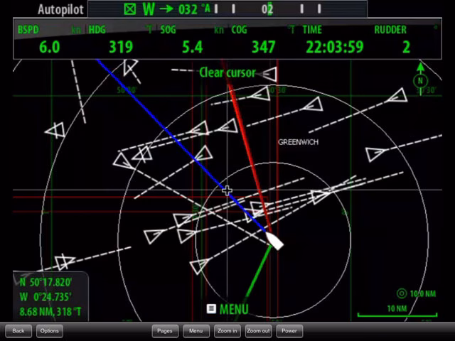
GPS Plotters: Can measure the distance between your vessel and any waypoint or charted feature instantly.
While these modern tools are highly accurate, seamanship tradition values the ability to judge distance without electronics in case of failure.
4. Using the Hand or Fist Method
That’s a neat old-school trick. At sea, when you don’t have instruments, your hands and fingers at arm’s length can be used to measure angles, which then help you judge distance, provided you know the height of the object (like a lighthouse, mast, or cliff).
When you stretch your arm out fully in front of you:
1 finger width ≈ 1° of arc
3 fingers ≈ 5°
A fist ≈ 10°
Spread hand (thumb to little finger) ≈ 20–25°
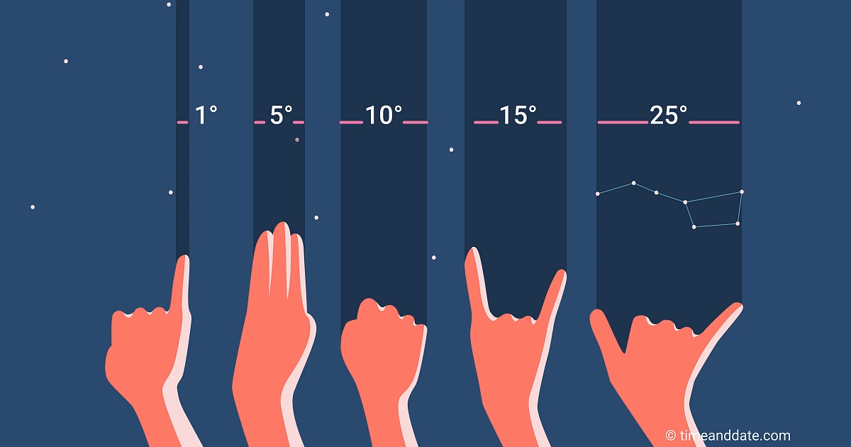
(This varies slightly by person, but it’s surprisingly consistent across most adults. This is because if you have larger fingers, you most likely have a larger arm, and hence your fingers are further away from your eyes, keeping the angle very similar.)
Example: A Ship’s Mast
Mast height = 15 m
Appears 2° high (about 2 fingers)
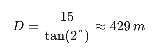
So the ship is less than half a kilometre away — a close quarters situation!
Limitations
Works best for moderate distances (< 10 km). Beyond that, angles are too small to measure accurately by hand.
Assumes you already know the object’s true height from a chart or sailing directions.
Atmospheric refraction can slightly distort apparent height near the horizon.
6. Rule of Thumb for Ships
Mariners sometimes use practical comparisons to estimate the distance to another vessel:
If you can see the bridge windows, the vessel is about 3–5 miles away.
If you can distinguish the hull’s waterline, it may be within 1–2 miles.
If you can make out the crew or rigging detail, the vessel is very close—less than half a mile.
Quick Ready-Reference Table
| Detail Visible | Approximate Distance (nm) |
|---|---|
| The ship just appeared above the horizon | 8–12 nm |
| Bridge windows | 3–5 nm |
| Hull waterline | 1–2 nm |
| Colour markings/funnels | ~1 nm |
| Rigging or crew | <0.5 nm |